

.png?width=50&name=SkyX%20Logo%20-%20Square%201%20(1).png)
Aerial data starts with thousands of raw images. The journey of images then requires evaluation to...
Unmanned Aerial Vehicle (UAV) inspections are gaining mindshare in pipeline integrity management applications, and why not? These autonomous aerial systems are ideal for surveying a pipeline corridor to source high-quality optics on your asset.
However, when surveying assets over vast distances, a UAV is going to generate an equally vast amount of raw imagery. Without the right tools for analysis, this can become an overwhelming burden for operators to make sense of.
Imagine you want to perform weekly flights with a UAV over a 30 km stretch of your right-of-way, to monitor for encroachment issues or evidence of a leak or a spill. This process will result in approximately 4,500 photos of the area per inspection. How do you turn all these images into practical data points around your assets? Have someone painstakingly comb through thousands of images every week?
Data analysis doesn’t have to be painful. By leveraging Artificial Intelligence (AI), within minutes we can distill thousands of images into critical data points that only require a small degree of human verification. With this critical data in hand, we can further compound the value of our aerial monitoring workflow, by building predictive models that further empower decision-making around asset monitoring and integrity management.
Let’s walk through this process, starting with the UAV. What it collects for us, why it’s useful, and how AI algorithms can bring out the truly valuable data.
UAVs Provide High-Quality, Albeit Raw Data
UAVs are well-suited for gathering superb aerial imagery that operators can use to visualize their assets and right-of-way. There is an assortment of UAVs on the market today, but here’s how a once-a-week inspection of a 30km pipeline ROW plays out with SkyX aerial systems:
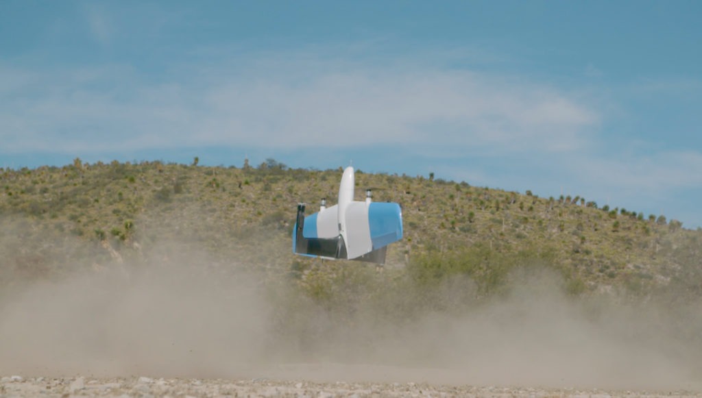
At the beginning of the ROW segment is an xStation. This is an all-weather ground station that provides shelter, communications relay, and weather monitoring while the UAV recharges for its next mission. From this station, the vehicle takes-off autonomously to perform its pre-programmed mission, while under observation by a remote pilot-in-command. The UAV surveys the entire 30km row segment in a single flight, capturing a series of overlapping high-resolution images of the entire ROW. The UAV then returns to the xStation, lands, and immediately transmits the data for analysis; all without intervention from the pilot.
However high the quality, sensors on the UAV are only capable of producing raw imagery. While this information can be of value to operators once processed – in the form of orthomosaics or simply georeferenced, time-stamped imagery logged in a GIS – the visual insights from a UAV only scratch the surface of the data available to operators.
The real value of a UAV that differentiates it from aerial inspections with a manned aircraft? Autonomy. With a system that lives and breathes directly on the pipeline ROW, and can operate without the need for on-site staff, we can frequently inspect the ROW without needing to mobilize resources and staff. Additionally, the aerial system is flying a precisely programmed flight path, allowing for image capture to occur with a high degree of accuracy from inspection-to-inspection.
In the same way that crude material needs refinement to become finished oil and gas products, raw visual data needs refinement into actionable data points to become something valuable. With a high level of consistency and frequency of inspections, we can leverage AI to expedite this process.
AI Refines Your Data from Raw to Actionable
As stated earlier, we’re going to be generating approximately 4500 images with each inspection of a 30 km pipeline ROW. For human analysis, this is a burden. For AI, it’s a benefit.
AI algorithms excel at analyzing vast amounts of data – images especially – to detect anomalies and categorize them. This ability only improves as you routinely feed data into the system. Once a baseline is established, and consistent visual data flows in on a routine basis, a computer vision system can leverage the information from historical archives to perform change detection analysis on each new data set.
When it comes to detecting encroachment, the system can flag simple objects such as structures, boundaries of build-up areas or vegetation during the baseline scan. With data from subsequent flights, change detection is used to identify more subtle indicators such as vegetation growth over time, changes in boundaries of built-up areas or construction activities nearing the ROW.
These same techniques can identify the telltale signs of a leak or a spill such as pools of oil, sheen on bodies of water, discolored soil, dead vegetation, and more.
However, while AI is a great tool capable of handling the bulk of your data analysis workload, it’s still an early-stage technology. Most algorithms and models are not yet mature enough to make complex decisions without human intervention. With verification of AI-flagged anomalies by a human subject matter expert, we can ensure we’re working the most critical points of data around pipeline integrity.
With these critical insights in hand, we can use them to unlock access to predictive analytics that get us in front of these issues on your ROW.
Predictive Analytics: Revolutionary Insights for Pipeline Integrity
The ability to predict critical issues before they manifest and schedule preventative maintenance accordingly is a massive boon. Being able to make these kinds of decisions allows you to manage resources optimally and reduce downtime of product transmission, ultimately improving the delivery yields of asset infrastructure.
This is the potential that predictive analytics has to offer your pipeline operation. With the age and scale of existing pipeline infrastructure, incidents related to leaks are a costly reality facing many operators. If you can address even a small percentage of these issues on your pipeline, you’re improving the efficiency of your operation by millions of dollars.
Let’s return to our pipeline ROW monitoring scenario, where we’re trying to mitigate issues around encroachment and leak detection:
- In the case of encroachment, we can leverage each anomaly that falls under this category – structures, construction, vegetation growth- to identify the hotspots or areas of concern along or near the ROW. Depending on the rate at which these encroachments are occurring, we can make an informed prediction on where and when we’re likely to see growth in the future and make efforts to stymie it.
- In the case of leak detection, we can calculate the rate at which leaks are occurring over time, and make a probable prediction of where and when we’re likely to see an incident. For further accuracy in our model, we can also combine the visual data of this aerial monitoring workflow with readings from SCADA systems. Leak anomalies detected visually can be cross-referenced with in-line readings – such as flow rate, pressure, temperature, etc. – to highlight common indicators of leaks on your pipeline. Going forward, the predictive model can notify you when you’re trending toward a leak-indicating threshold.
Don’t miss out on the truly valuable insights you stand to capture with an autonomous aerial data workflow. UAVs get fantastic imagery of a pipeline ROW, but AI can help you to understand what those images mean for ROW and asset management. By implementing these technologies to visualize your pipeline – images sourced by UAVs and AI-driven analysis – you can unlock access to the predictive analytics that can drive a paradigm-shift in standards for asset monitoring and integrity management.
Have questions about how high-quality aerial data can elevate your organization?
Contact our team to discuss your unique challenges and data requirements.