
The global Oil and Gas industry is faced with significant and sometimes costly pipeline integrity...
At SkyX, our mission is to become a leading global provider of intelligent, actionable aerial data for long-range and large infrastructure assets. Data that can be used to protect the health and safety of people and the planet now and in the future.
We carry out this mission by flying drones, also known as Unmanned Aerial Systems (UAS), above infrastructure assets to collect high-quality visual data on an ongoing basis. Then, we use our own industry-leading software to turn that data into actionable insights that empower companies to take a more proactive, informed approach to asset integrity.
When we begin an engagement with an infrastructure asset company, our conversation always starts with defining what valuable data the customer needs to collect. The type of data our customer is trying to gather determines the requirements of the mission and the characteristics of the vehicle we choose to fly.
There is no one-size-fits-all approach to drone aerial inspection that will deliver the optimal data in every scenario. We need to select the right solution for each mission.
Let’s start by looking at the monitoring application we’re laser-focused on right now.
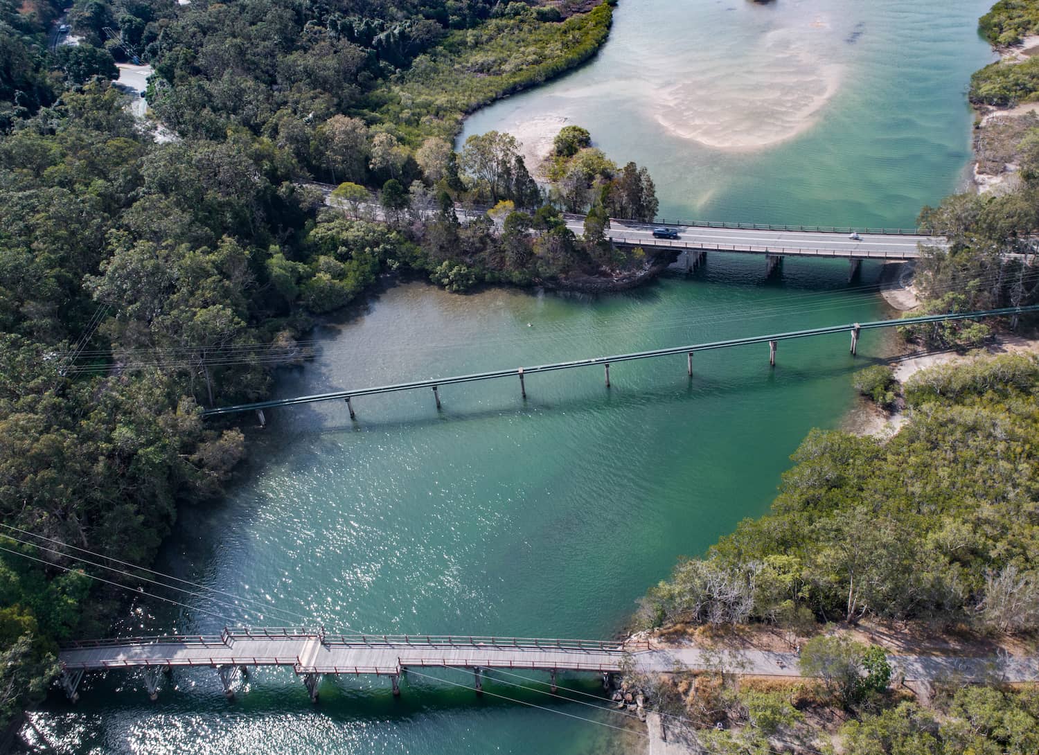
Midstream Oil and Gas pipelines
Think of a transmission pipeline from a monitoring standpoint. While a pipeline is a relatively simple structure, the complexity lies in the distance. Most often, we’re looking for leaks, potential causes of future damage like ground depression and vegetation encroachment as well as unauthorized third-party activity – most of which can be identified or verified using optical payloads. So, our primary consideration in this instance is having the endurance to perform long-range linear surveys. For this type of mission, the ideal UAS is typically one that is designed to make the most effective use of power for high-endurance flights.
Beyond pipelines
As we continue to grow and expand, providing solutions to companies around the world, we have our sights set on monitoring other types of infrastructure assets as well, each with its own unique data requirements.
Power lines
Similar to midstream Oil and Gas pipelines, power lines typically follow along, linear path with a well-defined right-of-way that makes it relatively easy to identify problem areas with third-party activity, vegetation encroachment, or damage from severe weather. So, the aerial system of choice must be the same one used for pipelines? For a broad right-of-way inspection, yes. But, the towers that form an integral part of transmission line infrastructure are complex multi-story structures that may require a closer look. In this instance, the right vehicle will offer both the endurance to adequately address the distance and the maneuverability to perform multi-point inspections of transmission towers.
Upstream Oil & Gas facilities
Not all asset inspections are a long-distance affair. In the case of upstream Oil and Gas, the job usually boils down to visually inspecting specific facilities and structures, such as drills and flare stacks. In many cases, an aerial system with hovering capability, stability and maneuverability is the right choice, providing the ability to inspect complex structures with ease. This is one application where endurance isn’t a concern as it involves performing a highly focused inspection on a modest area of coverage.
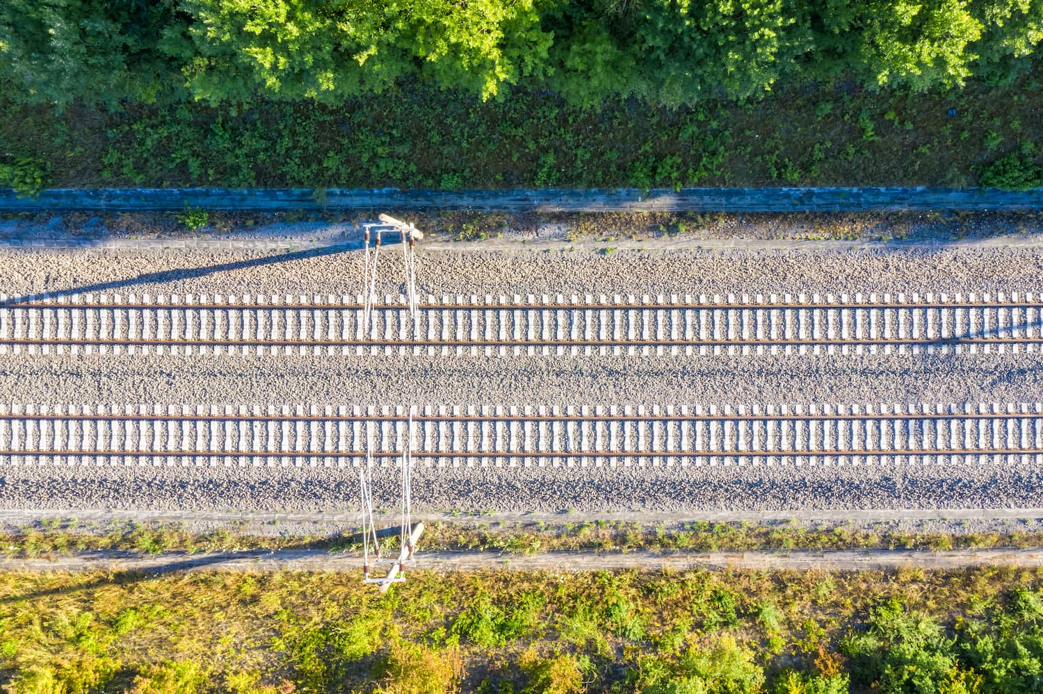
Railway lines
While the previous examples highlight the differences between vehicles, this application is a great example of the difference a payload can make. To provide meaningful data for track maintenance, railway inspections must capture very minuscule objects and details, such as the condition of bolts and fasteners and the distance between rails. For this reason, having a high-resolution camera is essential.
By hitting the sweet spot of camera spec and flight height, known as the ground sampling distance (or GSD), it’s possible to capture images with enough detail to examine these elements. For further insights, using a LiDAR sensor for 3D modelling can help you get precise information on issues such as flooding and erosion around the tracks.
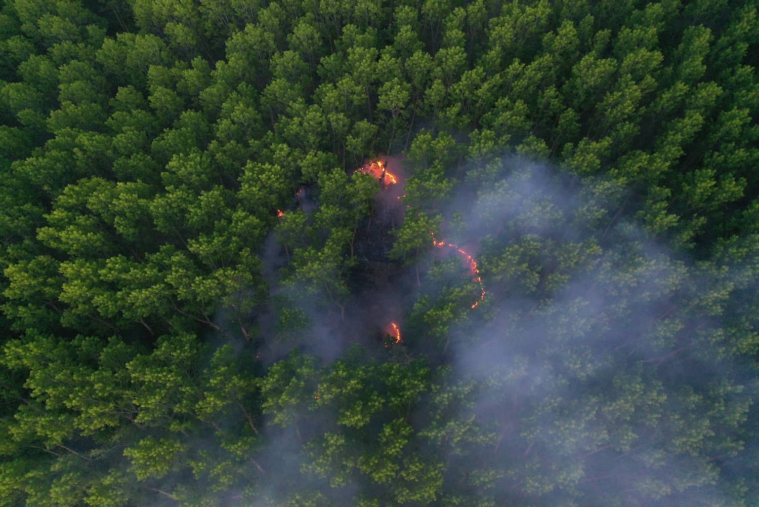
Wildfires
This final example highlights the importance of both vehicle and payload. In this application, an unmanned system that is designed for maneuverability is ideal due to the complexity of the mission. It needs to be able to make precise movements and to lock on to and track important targets of interest (animals or people). The ability to take off and land from virtually anywhere is also important for a mobile firefighter crew that is unable to launch and recover the aircraft from specific areas.
The quality of data you can get during wildfire monitoring is vastly improved by having the right payload. For instance, a gas spectrometer can be used to detect the level of particulates in the air from the fire, while a gimballed EO/IR camera is useful for thermal analysis, to better protect the team on the ground and aid in remediation efforts.
All in the pursuit of actionable data
Remember, collecting aerial data is just one part of the equation. Raw data only becomes meaningful once it’s processed by the brain, which at SkyX, takes the form of our SkyVision software. Using this technology to perform hyper-efficient analysis of raw data collected from each flight, we ensure that all of the data collected as well as actionable insights and highlights are delivered to the customer from each monitoring expedition.
By partnering with SkyX to make the aerial inspection a routine part of your monitoring operation, you gain access to the insights you need to take action to reduce risk and costs.
Ready to adopt a data-first approach to asset integrity?